About the Data Explorer
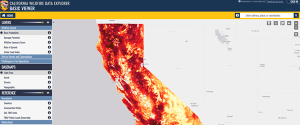
The California Wildfire Data Explorer (known as the “Data Explorer”) provides access to statewide maps of wildfire hazard and related information on surface fuels, fuel treatment locations, and historical fire occurrence. Additionally, multiple reference layers provide users with information on administrative boundaries, jurisdictional management, wildfire protection and suppression responsibility boundaries, and many more. The Data Explorer provides users with a consolidated experience for exploring wildfire issues across the state.
The Data Explorer information themes include wildfire hazard, demographic / socioeconomic, historical fire perimeters, political reference and administrative boundaries, watershed boundaries, wildfire response information, fuel treatment boundaries, and much more.
The Types of Data

Historical Fire Information
A comprehensive archive of historical fire information for California is maintained by the Fire and Resource Assessment Program (FRAP). These datasets can be explored in the Data Explorer alongside wildfire hazard maps and fuel treatment boundaries, or can be accessed through the Map Viewer, downloaded for use in GIS software, or viewed as a downloadable PDF map. More information on historical fire perimeters and many additional datasets can be accessed from the FRAP GIS Mapping and Data Analytics page.
Contemporary Wildfire Hazard and Risk
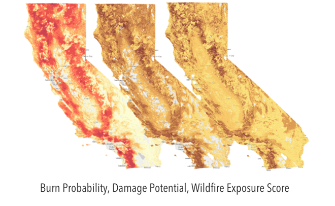
Statewide maps of wildfire hazard and risk provide the baseline information needed to support wildfire planning and mitigation efforts across the state. Land managers, local community groups, and private landowners alike require contemporary indices of wildfire hazard – consistently calculated and mapped across the state. The Wildfire Data Explorer (WDE) provides near-term estimates of wildfire likelihood and intensity (flame-length), indices of wildfire damage including ember load, and measures of wildfire suppression challenges. Data are updated on a near-annual basis or as source data become available. These data are distinct from Fire Hazard Severity Zones, which are legislatively mandated ratings to identify long-term fire hazard for use primarily in Wildland-Urban Interface (WUI) regulations. More information about FHSZ is available at the State Fire Marshal’s Fire Hazard Severity Zones page including a comprehensive FAQs guide.


Regional Planning
The Data Explorer provides community and regional planning groups with access to needed data for focusing wildfire hazard mitigation and prevention efforts within planning areas, to assist with project prioritization, and align priorities among partners through common data and visualizations. Data Explorer hazard layers are consistent with those curated as part of the California Landscape Metrics and proposed as part of the Core Reporting Metrics currently in development to assess and monitor progress toward resiliency in fire-prone landscapes.
Ready to Learn More?

California Wildfire Data Explorer
Open the Data Explorer to view and learn more about all of the data mentioned above. It’s free to the public and easy to use. Or, sign up to gain Advanced access, best suited for Emergency Managers, Natural Resource Professionals, Wildland Fire Response and more.
Contact Us
Required fields are marked with an asterisk (*).
